Best Areas in Palm Springs for Outdoor Activities and Hiking
Palm Springs is one of the easiest desert towns to hike. Most trailheads sit minutes from downtown, yet they lead to palm oases, waterfalls, and 10,000-foot peaks. I drive down from Bakersfield a few times a year, and the areas below are the ones I keep going back to.
This guide breaks down the best areas in Palm Springs for outdoor activities and hiking, with 2026 fees, hours, difficulty, and the heat rules that actually keep you safe.
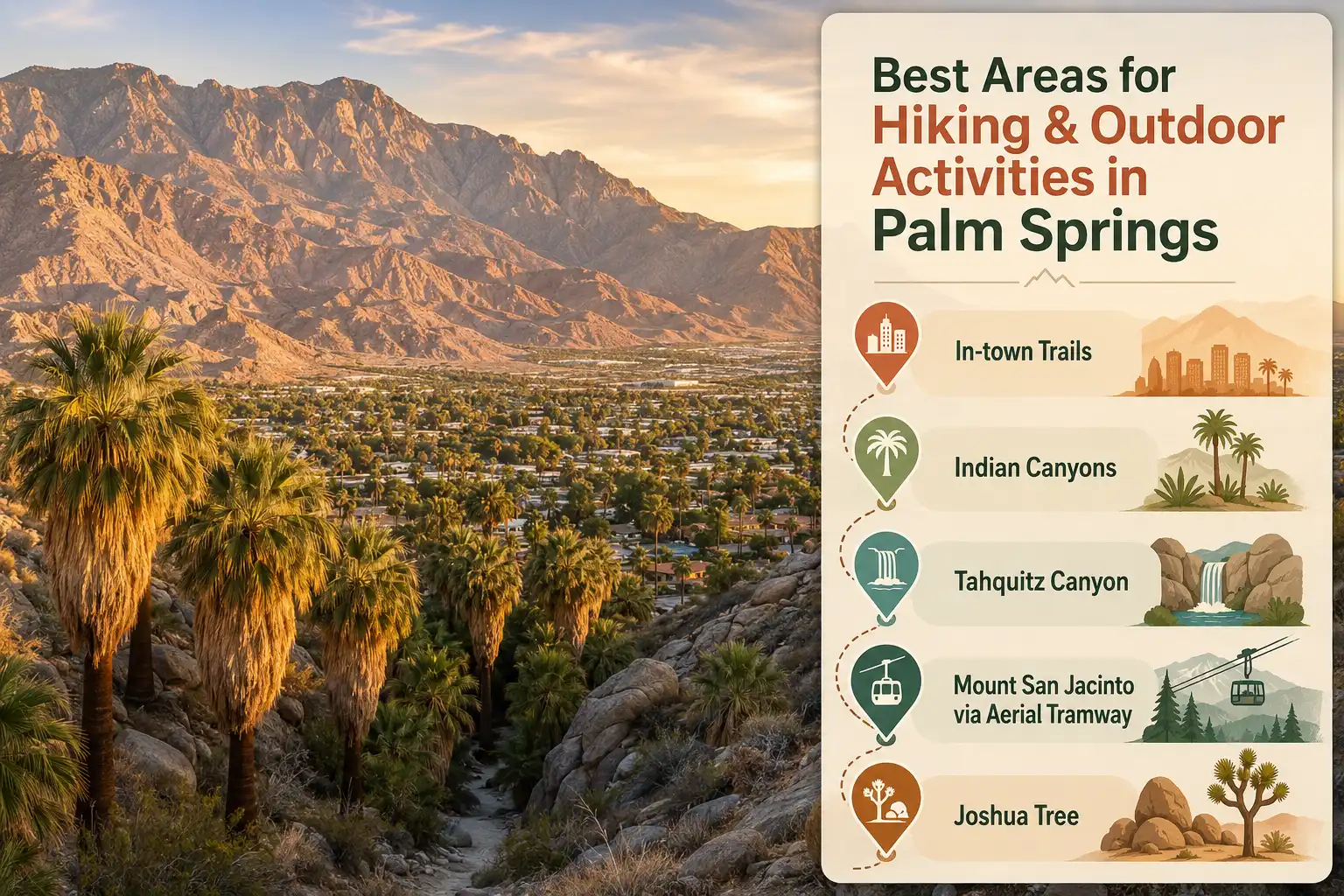
Which Palm Springs hiking area is right for you?
Choose in-town trails for free sunrise or sunset hikes, Indian Canyons for shaded palm oases, Tahquitz Canyon for a waterfall, Mount San Jacinto for cool alpine air, or Joshua Tree for a bigger desert adventure.
Museum, Lykken and Araby trails are free and close to downtown.
Shaded palm groves and creek walks that work well for families.
A scenic 2-mile loop leading to a 60-foot seasonal waterfall.
Cool alpine forest and the best summer escape from the valley heat.
Giant boulders, Joshua trees and bigger desert day-trip options.
When Is the Best Time to Hike in Palm Springs?
October through April is the best time to hike in Palm Springs, because daytime temperatures stay comfortable then. Summer is a different story.
Best Overall Window
Any trail and generally any time of day works well during the cooler hiking season.
Go Early
Early starts are good, but keep a close eye on afternoon temperatures.
Beat the Heat
Stick to low trails around sunrise or ride the mountain to escape the valley heat.
Desert Heat Is the Rule That Matters Most
From June through September, valley highs often pass 100°F, and the heat turns dangerous fast. Because of that, local fire crews reported a jump in trail rescues during summer 2026, and officials keep urging hikers to start before sunrise or skip the low routes entirely.
When heat gets extreme, California State Parks has even closed the Skyline (Cactus to Clouds) Trail until conditions improve. So plan around the temperature, not the calendar.
For more on staying safe in extreme desert heat , sort out your water and timing before you leave the car.
In-Town Trails: Hiking Straight From Downtown
Some of the best hikes start at the edge of the city, so you can park downtown and be climbing within minutes. These trails are free, with no gates or fees. They also work best at first light or in the evening during the warm months.
Museum Trail
Steep trail with wide city views and a link to the ridge.
South Lykken Trail
Picnic tables and valley overlooks make this a strong short option.
North Lykken Trail
A ridge walk high above town with broad views over Palm Springs.
Araby Trail
A longer foothill route that passes the old Bob Hope estate.
Want More Trail Options?
These foothill paths connect, so you can build a longer loop from several starting points. Explore a wider set of trail options close to town.
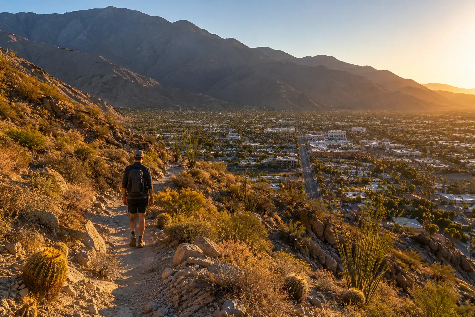
Hiker climbing a rocky foothill trail above downtown Palm Springs with the desert city and palm trees below
Indian Canyons: Palm Oases and Creek Trails
The Indian Canyons are the ancestral home of the Agua Caliente Band of Cahuilla Indians, and they hold the greenest hiking in the desert. Shade, running water, and red rock make these canyons feel nothing like the open desert nearby.
Palm Canyon
- Distance: ~2 miles round trip
- Difficulty: Easy to moderate
- Highlight: Natural fan palm oasis
- Longer routes: Available
Andreas Canyon
- Distance: ~1 mile
- Difficulty: Easy
- Highlight: Shaded creek
- Scenery: Striking rock formations
Palm Canyon
About 2 miles round trip, with longer routes available. Easy to moderate and home to the world’s largest natural fan palm oasis.
Andreas Canyon
About 1 mile and easy, with a shaded creek and striking rock formations.
Murray Canyon
Around 4 miles round trip and moderate, with roughly 600 feet of gain. The trail leads toward the Seven Sisters waterfalls.
Plan Around the Gates
Gates run daily from 8 a.m. to 5 p.m. between October 1 and July 4, then Friday through Sunday only until September 30. Dogs are not permitted.
On my visits, I start with Andreas for the shade, then add Murray if the morning is still cool.
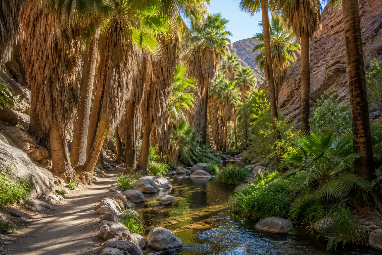
Shaded grove of California fan palms lining a clear stream inside the Indian Canyons near Palm Springs
Tahquitz Canyon: The Waterfall Hike
Tahquitz Canyon is a 2-mile loop that climbs to a 60-foot seasonal waterfall, just southwest of downtown. It sits on Agua Caliente land, so it charges its own entry fee, separate from the Indian Canyons.
Children 12 and under are $6.
Each hiker must carry at least 32 ounces of water.
Dogs are not permitted on the canyon trail.
Go When the Falls Are Strongest
Hours run from 7:30 a.m. to 5 p.m., and the last hiker heads out at 3:30 p.m. After July 4, it opens Friday through Sunday only.
The falls run strongest in winter and spring, so time your trip then if the water is your goal. Rangers also lead guided hikes from the visitor center, which add real context on the canyon’s history.
Mount San Jacinto State Park: The Cool-Air Escape
For a break from the heat, Mount San Jacinto State Park is the best area in Palm Springs to hike in summer. The Palm Springs Aerial Tramway climbs from the desert floor to a mountain station at 8,516 feet in about ten minutes, and the air up top can run 30 degrees cooler.
Long Valley Loop
A quick forest stroll from the mountain station.
Round Valley Trail
Meadows and shaded pine forest make this a longer mountain option.
San Jacinto Peak
The serious summit route for fit and prepared hikers.
Two Things to Know Before Riding Up
A free wilderness permit, available at the ranger station near the tram, covers the longer routes. Book online because the tram fills up on busy days.
The tramway closes for annual maintenance from September 8 through early October 2026. Leave the dog at home, since the tram and the park’s trails don’t allow pets.
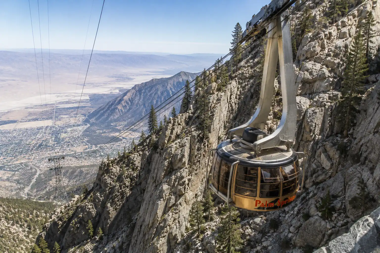
Palm Springs Aerial Tramway car ascending the steep cliffs of Chino Canyon with the desert valley far below
The Cactus to Clouds Route
Cactus to Clouds is one of the hardest day hikes in the country, gaining over 10,000 feet from the desert floor to the peak. Only very fit, well-prepared hikers should try it.
Most people climb the brutal lower Skyline section, then ride the tram down. Since heat makes the lower part deadly, save this one for cool months, and check whether the trail is open before you commit.
Great Outdoor Areas a Short Drive Away
Palm Springs also works as a base for bigger day trips. If you have the time, three nearby areas stand out.
About 45 to 60 minutes north. Famous for boulders, twisted trees, and moderate walks like the 3-mile 49 Palms Oasis.
Near Thousand Palms. The easy roughly 2-mile McCallum Trail crosses a palm oasis along the San Andreas Fault, with no entry fee.
In Morongo Valley. Free to enter and home to more than 240 bird species, with trails ranging from short strolls to 11 miles.
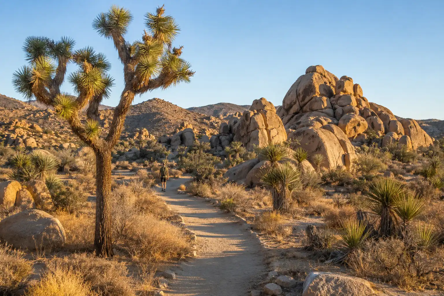
Desert hiking trail winding past Joshua trees and granite boulder piles in Joshua Tree National Park near Palm Springs
Beyond Hiking: Other Outdoor Activities
Hiking is only part of the picture. If you want to mix things up, Palm Springs has plenty of options.
Ride through the Indian Canyons and nearby desert areas.
Cruiser and road biking on the flat bike lanes downtown.
Explore the valley on guided off-road adventures.
Take in the desert landscape from above.
Joshua Tree is world famous for its granite climbing.
The Heat Rules Still Apply
Whatever you choose, the same heat rules apply, so plan around the temperature.
What to Pack for a Desert Hike
Desert hiking is safe when you respect the heat and pack for it. Here’s what I never leave the car without.
Carry at least 3 liters of water. Tahquitz alone requires 32 ounces per person.
Bring a wide-brim hat, sunscreen, and light, long sleeves.
Wear shoes with real grip for loose, rocky desert trails.
Carry a charged phone with an offline map because cell service drops out fast.
Bring salty snacks or electrolytes for anything over a couple of miles.
Start Early. Carry More Water Than You Think.
Beyond the packing list, start early, tell someone your route, and turn back the moment you feel off.
Those are the desert gear basics I rely on every trip.
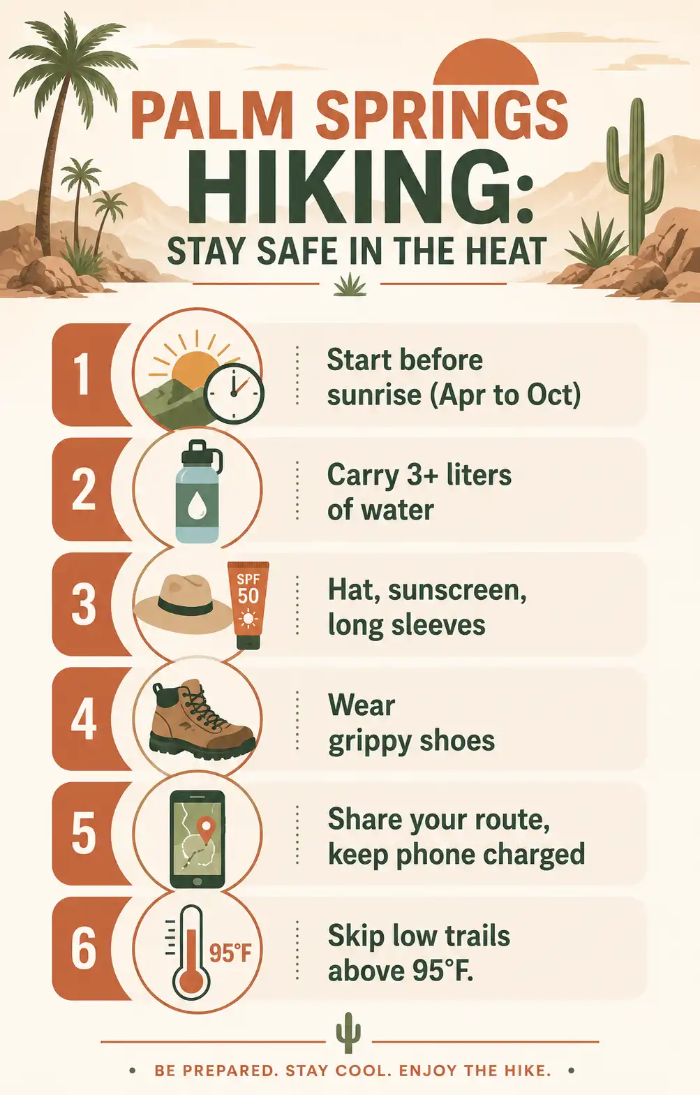
Heat-safety checklist for hiking in Palm Springs, including water, early starts, and grippy footwear
How I’d Spend One Day Hiking in Palm Springs
Start at sunrise for cooler temperatures and city views.
Cool off among the palms and shaded creek trails.
When the valley heats past 90°F, head up to the cooler mountain air.
That mix gives you city views, a shaded oasis, and alpine air in one day. Match the area to the season, start early, and carry more water than feels necessary. Do that, and this small desert town delivers hiking from the valley floor to the pines.
FAQs About the Best Areas in Palm Springs for Outdoor Activities and Hiking
What is the best time of year to hike in Palm Springs?
October through April is generally the best hiking season because daytime temperatures are more comfortable. From June through August, low-elevation trails should be limited to sunrise, or you can ride the tram to cooler mountain elevations.
What are the best free hiking areas near Palm Springs?
The Museum, South Lykken, North Lykken, and Araby trails are free and start close to downtown. Coachella Valley Preserve and Big Morongo Canyon Preserve are also free outdoor areas nearby.
Are Indian Canyons good for families?
Yes. Indian Canyons offer easier routes such as Andreas Canyon, along with shaded palm groves, creek walks, and scenic red rock.
How much does Indian Canyons cost in 2026?
Entry is $12 for adults, $7 for seniors 62 and up and students, and $6 for children ages 6 to 12. Active military enter free.
Is Tahquitz Canyon worth visiting?
Tahquitz Canyon is a strong choice if you want a relatively short scenic hike with a seasonal waterfall. The loop is about 2 miles, with roughly 350 feet of elevation gain and a 60-foot waterfall.
Is Palm Springs good for hiking in summer?
Yes, but you need to choose your route carefully. Low-elevation trails are best around sunrise during summer, while Mount San Jacinto provides a much cooler alpine alternative.
What should I pack for hiking in Palm Springs?
Carry at least 3 liters of water, sun protection, grippy hiking shoes, a charged phone with an offline map, and salty snacks or electrolytes for longer hikes.