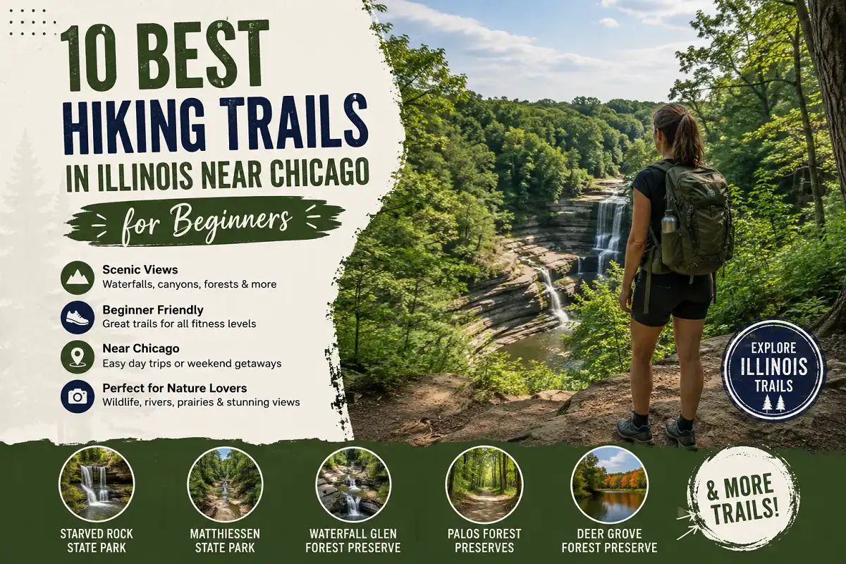
10 Best Hiking Trails in Illinois Near Chicago for Beginners
Chicago is surrounded by far more hiking opportunities than many visitors expect. You do not have to drive deep into the Midwest to find wooded trails, prairie landscapes, river views, sandstone canyons, waterfalls, and peaceful nature preserves.
Some of the best hiking near Chicago is right inside the city or in the surrounding suburbs, while other trails make excellent half-day or full-day road trips.
Best Hiking Trails in Illinois Near Chicago
If you want dramatic scenery, Starved Rock State Park and Matthiessen State Park are hard to beat. For a shorter trip, Waterfall Glen, Deer Grove, and the North Branch Trail offer easier access from the Chicago area.
Here are some of the best hiking trails in Illinois near Chicago, including location details and what makes each one worth the trip.
10 Best Hiking Trails in Illinois Near Chicago for Every Adventure
It naturally includes the main keyword “best hiking trails in Illinois near Chicago” while also sounding useful and clickable. Current hiking guides similarly emphasize the variety of trails around Chicago, from Starved Rock and Waterfall Glen to urban and suburban routes.
Explore seasonal waterfalls and dramatic canyon scenery.
Experience wide-open grasslands and Illinois wildlife.
Find convenient hiking and walking routes inside Chicago.
Enjoy wooded trails without traveling far from the city.
Choose extended trails for longer outdoor adventures.
Starved Rock State Park
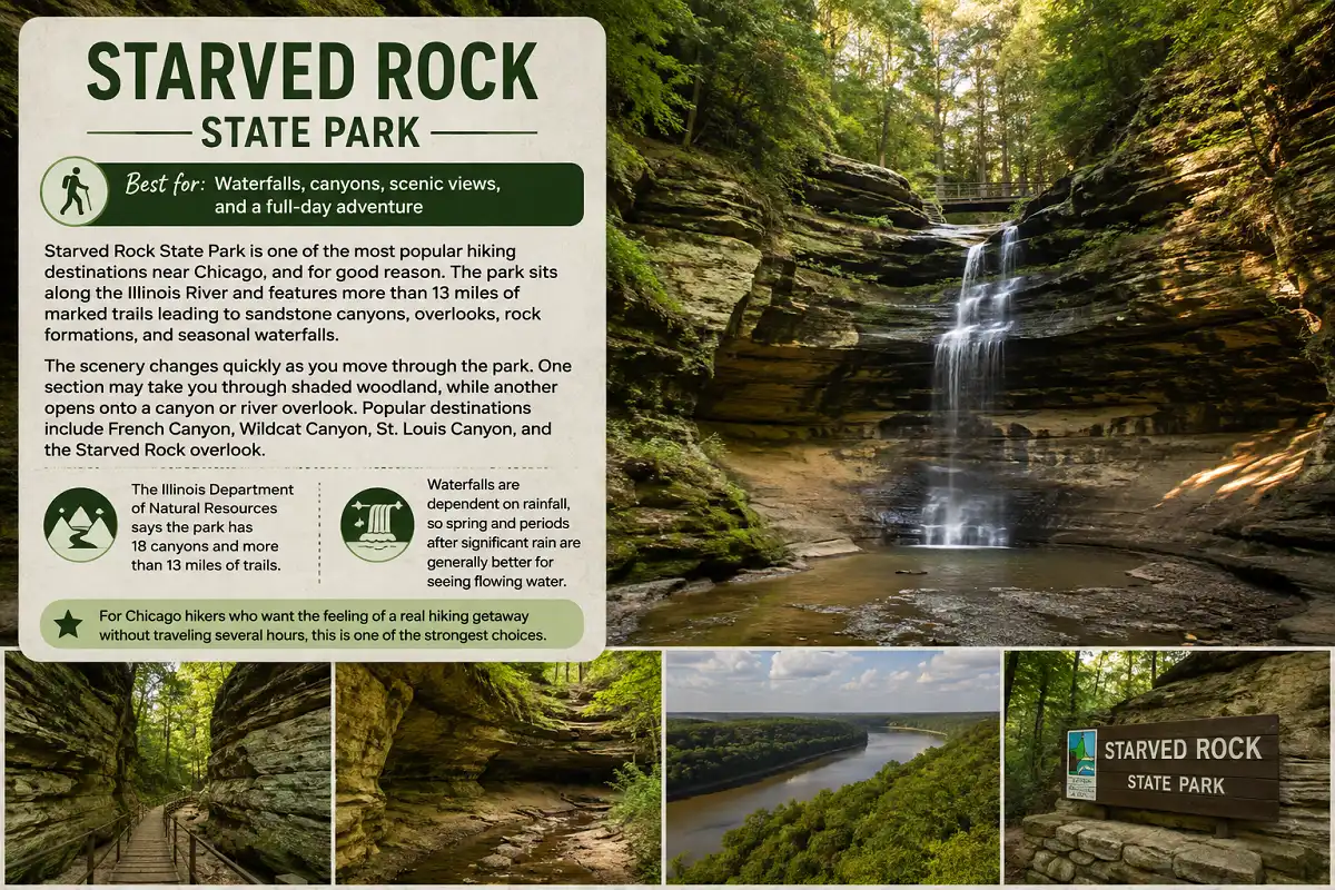
Starved Rock State Park is one of the most popular hiking destinations near Chicago, and for good reason. The park sits along the Illinois River and features more than 13 miles of marked trails leading to sandstone canyons, overlooks, rock formations, and seasonal waterfalls.
The scenery changes quickly as you move through the park. One section may take you through shaded woodland, while another opens onto a canyon or river overlook. Popular destinations include French Canyon, Wildcat Canyon, St. Louis Canyon, and the Starved Rock overlook.
The Illinois Department of Natural Resources says the park has 18 canyons and more than 13 miles of trails. Waterfalls are dependent on rainfall, so spring and periods after significant rain are generally better for seeing flowing water.
For Chicago hikers who want the feeling of a real hiking getaway without traveling several hours, this is one of the strongest choices.
Good to know
Expect stairs and uneven terrain in the canyon areas. Stay on marked trails because the canyon walls and cliffs can be dangerous.
Waterfall Glen Forest Preserve
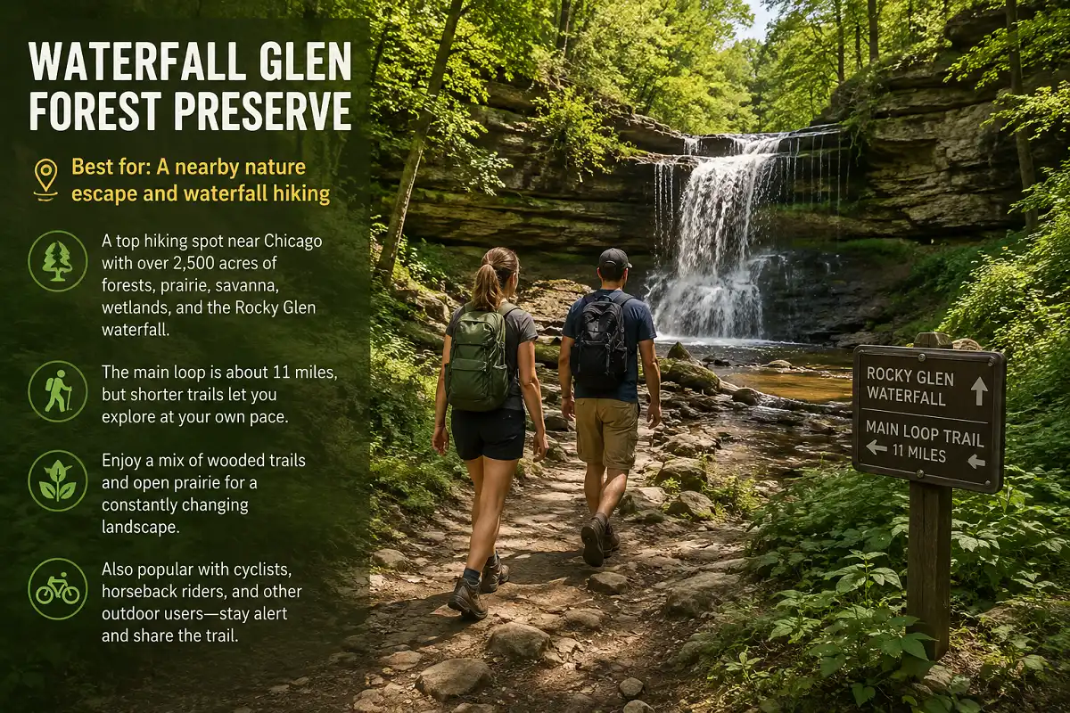
If you want one of the best hiking spots near Chicago without committing to a long road trip, Waterfall Glen Forest Preserve is an excellent option.
Located southwest of Chicago near Darien, the preserve covers more than 2,500 acres and includes forests, prairie, savanna, wetlands, and the Rocky Glen waterfall. The main loop is roughly 11 miles, although you can choose shorter sections if you do not want to hike the entire route.
The landscape makes this preserve especially interesting. Instead of walking through one type of environment for miles, you move between wooded areas and more open sections of restored prairie.
It is also a popular place for cyclists, horseback riders, and other outdoor users, so keep an eye on your surroundings when sharing the trail.
Good to know
Conditions around the waterfall and unpaved sections can change after rain.
Matthiessen State Park
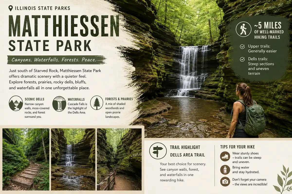
Matthiessen State Park sits just south of Starved Rock and is an excellent choice if you want dramatic Illinois scenery with a slightly different atmosphere.
The park combines forests, prairie, rocky dells, bluffs, and waterfalls. Its Dells Area is particularly scenic, with trails leading through narrow canyon-like formations and toward Cascade Falls.
Illinois State Parks lists about 5 miles of well-marked hiking trails. The upper areas are generally easier, while trails into the dells can become more difficult because of steep sections and uneven terrain.
The Dells Area Trail is a particularly good choice if your main goal is scenery. You can see moss-covered canyon walls, forest, and the park’s waterfall areas in one outing.
Good to know
Trails inside the dells can be steep and difficult, especially when conditions are wet.
Midewin National Tallgrass Prairie

Midewin National Tallgrass Prairie offers a completely different hiking experience from the canyon trails around Starved Rock.
Instead of narrow rock formations and waterfalls, Midewin is characterized by wide-open prairie, rolling grasslands, wildlife, and big skies. The landscape is particularly appealing if you enjoy birdwatching or want a quieter hike away from heavily wooded trails.
The preserve has dedicated hiking routes as well as shared trails. One of its major attractions is the bison herd, which was reintroduced to the prairie and has become one of the area’s signature wildlife experiences.
Good to know
Bison are wild animals, so observe them from a safe distance and never approach them.
Kankakee River State Park
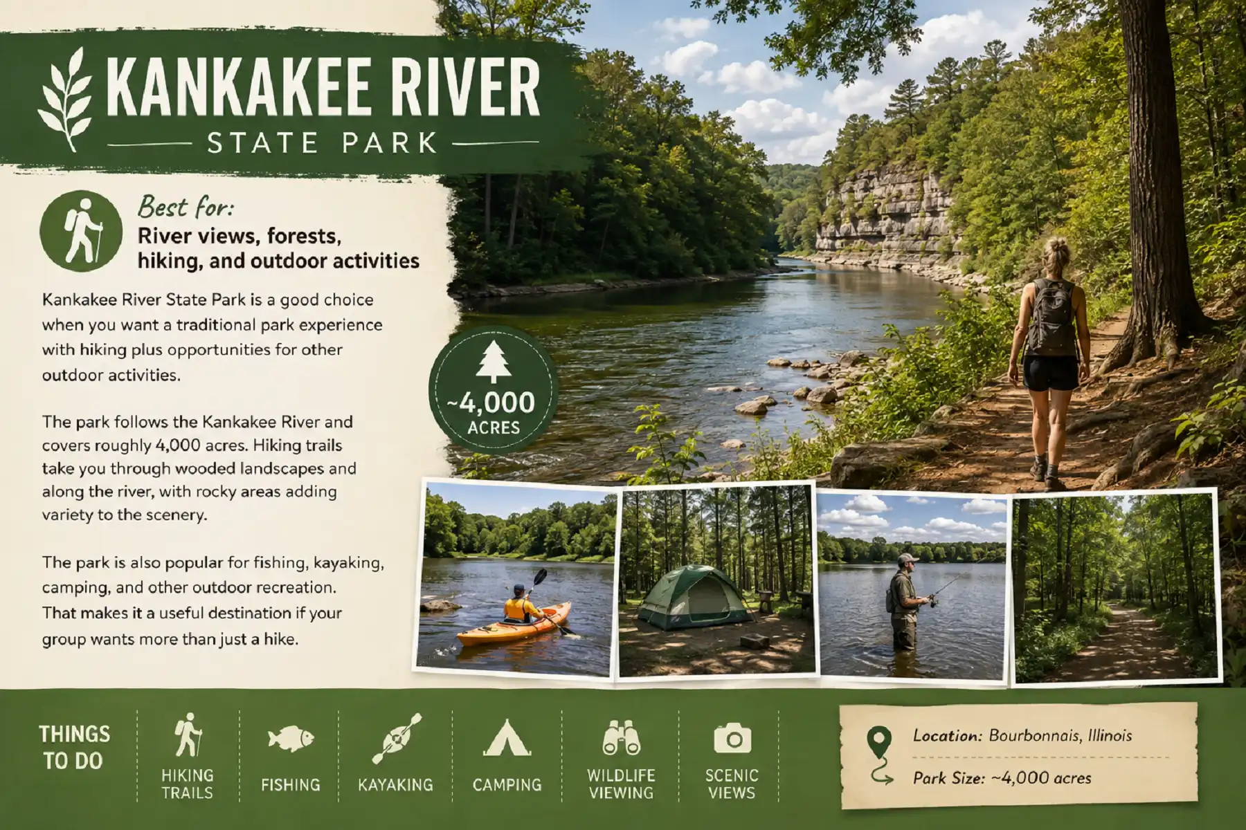
Kankakee River State Park is a good choice when you want a traditional park experience with hiking plus opportunities for other outdoor activities.
The park follows the Kankakee River and covers roughly 4,000 acres. Hiking trails take you through wooded landscapes and along the river, with rocky areas adding variety to the scenery.
The park is also popular for fishing, kayaking, camping, and other outdoor recreation. That makes it a useful destination if your group wants more than just a hike.
Good to know
Consider making a full day of the visit if you want to combine hiking with river activities.
The Morton Arboretum
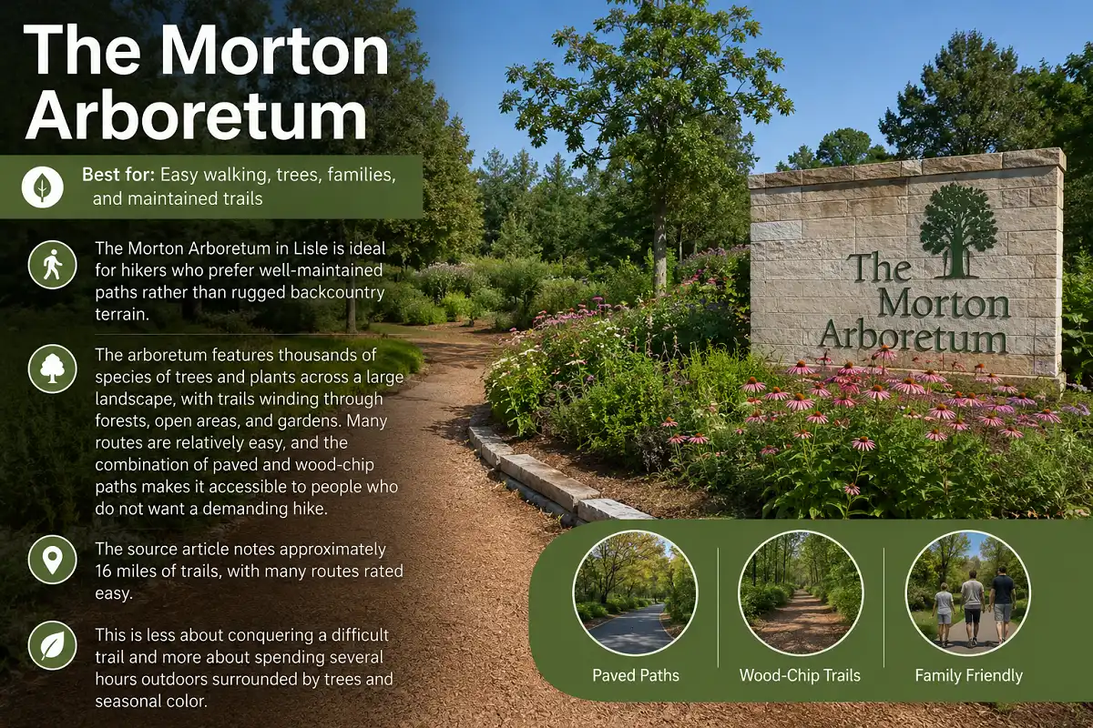
The Morton Arboretum in Lisle is ideal for hikers who prefer well-maintained paths rather than rugged backcountry terrain.
The arboretum features thousands of species of trees and plants across a large landscape, with trails winding through forests, open areas, and gardens. Many routes are relatively easy, and the combination of paved and wood-chip paths makes it accessible to people who do not want a demanding hike.
The source article notes approximately 16 miles of trails, with many routes rated easy.
This is less about conquering a difficult trail and more about spending several hours outdoors surrounded by trees and seasonal color.
Good to know
Check the arboretum’s current admission and operating information before visiting.
North Branch Trail
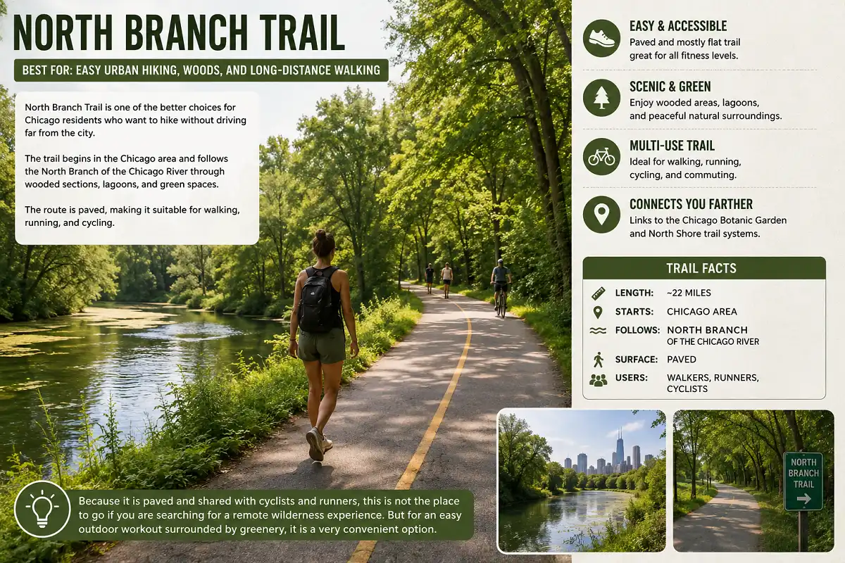
North Branch Trail is one of the better choices for Chicago residents who want to hike without driving far from the city.
The trail begins in the Chicago area and follows the North Branch of the Chicago River through wooded sections, lagoons, and green spaces. The route is paved, making it suitable for walking, running, and cycling.
The trail system extends for roughly 22 miles and connects with other trails toward the Chicago Botanic Garden and North Shore area.
Because it is paved and shared with cyclists and runners, this is not the place to go if you are searching for a remote wilderness experience. But for an easy outdoor workout surrounded by greenery, it is a very convenient option.
Deer Grove Forest Preserve
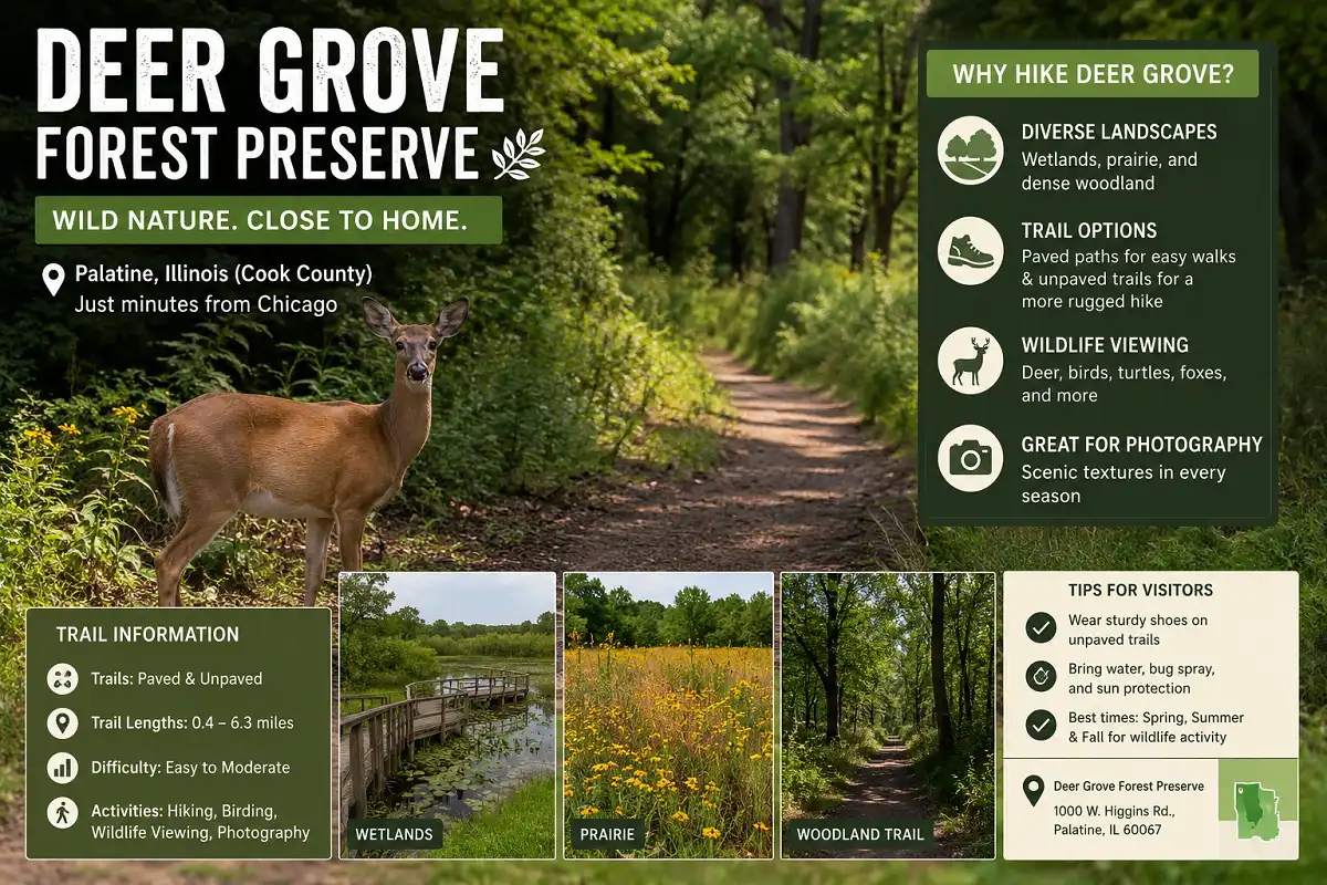
Deer Grove Forest Preserve in Palatine is a great suburban hiking option for people who want more natural terrain without traveling far from Chicago.
The preserve contains wetlands, prairie, and dense woodland. Some paths are paved, while other sections are unpaved and more challenging.
The unpaved trails are especially appealing if you want your walk to feel more like a traditional hike rather than a paved recreational path. Wildlife viewing is another major reason to visit.
The 606 – Bloomingdale Trail

The 606 is one of the most unusual hiking and walking options on this list because it runs directly through Chicago.
Built on an abandoned elevated railway, the trail gives walkers a green corridor through several neighborhoods. It is paved, relatively easy, and much more urban than the forest preserves and state parks farther outside the city.
The trail stretches for about 2.7 miles from end to end, making it better suited to an urban walk, run, or short hike than a full wilderness outing.
It is especially convenient when you want to get outside without leaving Chicago.
Good to know
The trail can become busy during popular times, so expect plenty of other pedestrians and runners.
Des Plaines River Trail
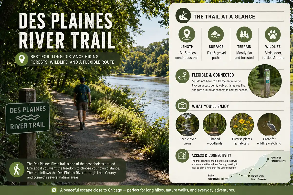
The Des Plaines River Trail is one of the best choices around Chicago if you want the freedom to choose your own distance.
The trail follows the Des Plaines River through Lake County and connects several natural areas. The source article describes a continuous trail of about 31.5 miles, with dirt and gravel surfaces and sections passing through forest preserves.
You do not have to hike the entire route. Pick an access point, walk as far as you like, and turn around or connect to another section.
The combination of river scenery, woodland, plants, and wildlife makes this a strong option for hikers who enjoy longer outings without the steep canyon terrain found at Starved Rock.
Good to know
Check your specific access point and trail conditions before starting a long hike.
Which Chicago-Area Hike Should You Choose?

The best trail depends on the kind of hiking experience you want.
Starved Rock State Park
Starved Rock State Park or Matthiessen State Park
Waterfall Glen Forest Preserve
Midewin National Tallgrass Prairie
The Morton Arboretum
The 606
North Branch Trail
Deer Grove Forest Preserve
Des Plaines River Trail
Kankakee River State Park
Tips for Hiking Near Chicago
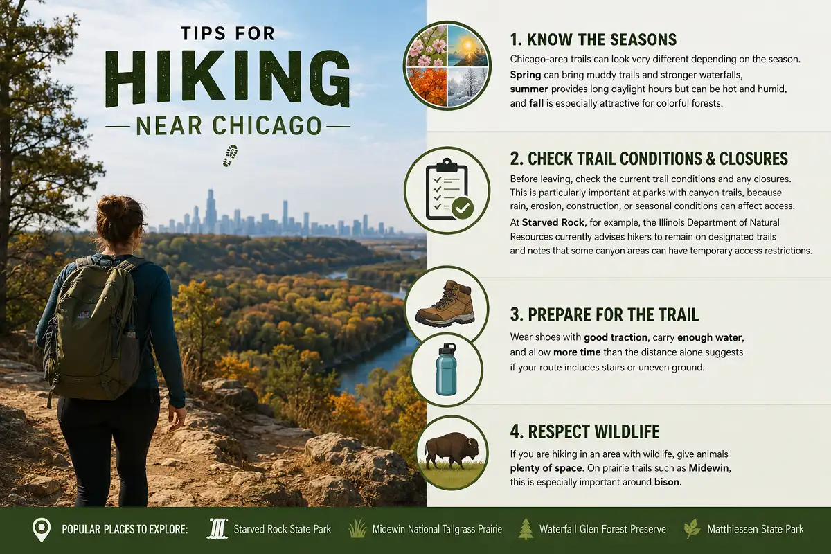
Chicago-area trails can look very different depending on the season. Spring can bring muddy trails and stronger waterfalls, summer provides long daylight hours but can be hot and humid, and fall is especially attractive for colorful forests.
Before leaving, check the current trail conditions and any closures. This is particularly important at parks with canyon trails, because rain, erosion, construction, or seasonal conditions can affect access.
Conditions can change after rain, especially on unpaved and canyon trails.
Shoes with good traction are useful on uneven, muddy, or wet terrain.
Allow more time than the distance alone suggests when your route includes stairs or uneven ground.
Give animals plenty of space, especially around bison at Midewin National Tallgrass Prairie.
At Starved Rock, for example, the Illinois Department of Natural Resources currently advises hikers to remain on designated trails and notes that some canyon areas can have temporary access restrictions.
Wear shoes with good traction, carry enough water, and allow more time than the distance alone suggests if your route includes stairs or uneven ground.
If you are hiking in an area with wildlife, give animals plenty of space. On prairie trails such as Midewin, this is especially important around bison.
Where to Start Your Illinois Hiking Adventure
Whether you want a quick nature escape from Chicago or a full-day hiking adventure, Illinois has plenty of trails worth exploring.
If you’re new to hiking, it’s worth learning a few basic skills before choosing a longer or more difficult route with this beginner hiking guide.
Start with Waterfall Glen or Deer Grove if you want something closer to the city, or make the drive to Starved Rock State Park and Matthiessen State Park for canyons, waterfalls, and more dramatic scenery. Starved Rock has more than 13 miles of hiking trails and 18 canyons, making it one of the area’s standout destinations.
The best trail for you ultimately depends on how far you want to drive, how difficult you want the hike to be, and what kind of scenery you enjoy.
Before taking on a trail with significant climbs, you can also learn how much elevation gain is a lot hiking so you have a better idea of what to expect.
Check current trail conditions before leaving, wear shoes with good traction, and give yourself enough time to enjoy the route instead of rushing to the finish.
With so many hiking options around Chicago, you can easily find a trail for a relaxed morning walk, a challenging day outdoors, or your next weekend adventure.
Frequently Asked Questions About Hiking Near Chicago
What is the best hiking trail near Chicago?
Starved Rock State Park is one of the strongest overall choices for hiking near Chicago. It offers more than 13 miles of trails, 18 canyons, sandstone formations, river overlooks, and seasonal waterfalls. It is especially good for hikers looking for dramatic scenery and a full-day outdoor adventure.
Where can I hike near Chicago without driving far?
Waterfall Glen Forest Preserve, Deer Grove Forest Preserve, North Branch Trail, The Morton Arboretum, and The 606 are convenient options. Waterfall Glen and Deer Grove provide more natural forest and preserve scenery, while North Branch Trail and The 606 are easier urban and paved options.
Which hiking trail near Chicago has waterfalls?
Starved Rock State Park and Matthiessen State Park are two of the best choices for waterfall scenery. Waterfall Glen Forest Preserve also has the Rocky Glen waterfall. Waterfall flow can depend heavily on recent rainfall, so conditions may vary by season and weather.
What is the best Chicago-area hike for beginners?
The Morton Arboretum is a good choice for beginners who prefer well-maintained and relatively easy paths. North Branch Trail and The 606 are also convenient if you want paved surfaces and a less demanding outdoor experience. Waterfall Glen and Deer Grove offer additional options when you are ready for more natural terrain.
What should I bring when hiking near Chicago?
Bring enough water, comfortable shoes with good traction, weather-appropriate clothing, and enough time to complete your chosen route without rushing. Check trail conditions and closures before leaving, especially after rain. On trails with wildlife such as Midewin National Tallgrass Prairie, keep a safe distance from animals and never approach bison.