Best Hiking Trails in Big Bear, CA: A Local (Guide)
Big Bear has more trails than a long weekend can cover, so the hard part is picking the right one for your group and your skill level. I drive up here from Bakersfield whenever I need mountain air, and over the years I have sorted the standouts from the merely okay.
This guide walks through the best hiking trails in Big Bear CA by difficulty, with honest distances, current parking and permit rules, and the views that actually earn the climb.
The best Big Bear hikes at a glance
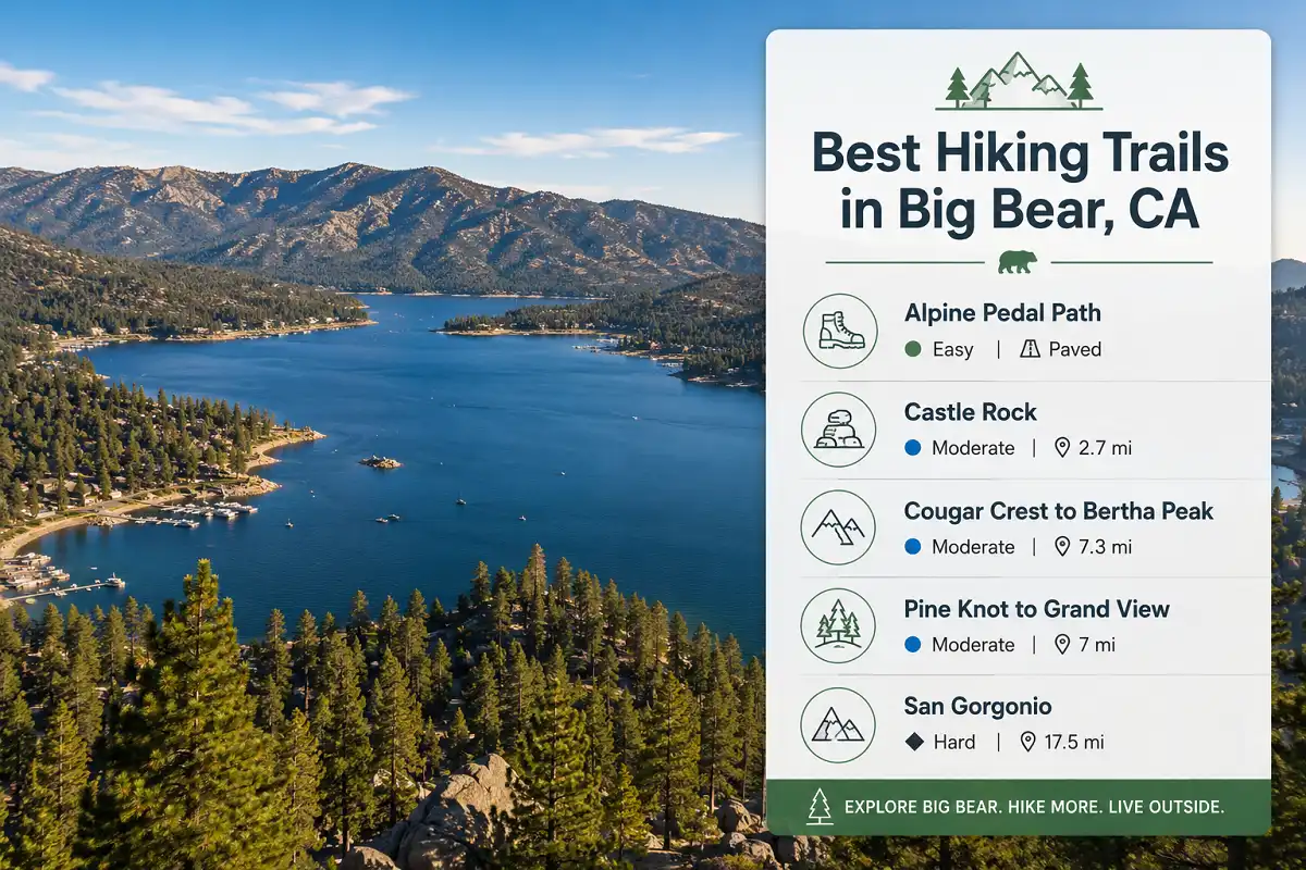
The best hiking trails in Big Bear CA run from easy paved paths to a serious alpine summit. Castle Rock (2.7 miles) delivers big lake views fast. Cougar Crest to Bertha Peak (7.3 miles) and Pine Knot to Grand View Point (about 7 miles) reward moderate hikers. For a real challenge, San Gorgonio tops out at 11,503 feet. Most trailheads need an Adventure Pass to park.
Flat, paved and family-friendly with winter bald eagle sightings.
Short paved loop with picnic areas and minimal elevation.
2.7 miles with fast lake views and a steep opening climb.
Extend to Bertha Peak for panoramic mountain and lake views.
11,503 feet and a serious full-day backcountry objective.
What makes Big Bear such good hiking country
Big Bear Lake sits at about 6,750 feet in the San Bernardino Mountains, so the air is thin, cool, and pine scented even in July. Because the lake anchors a whole valley of ridges, you get trails for every mood. Some hug the shoreline on flat pavement. Others climb granite outcrops or push toward high desert overlooks.
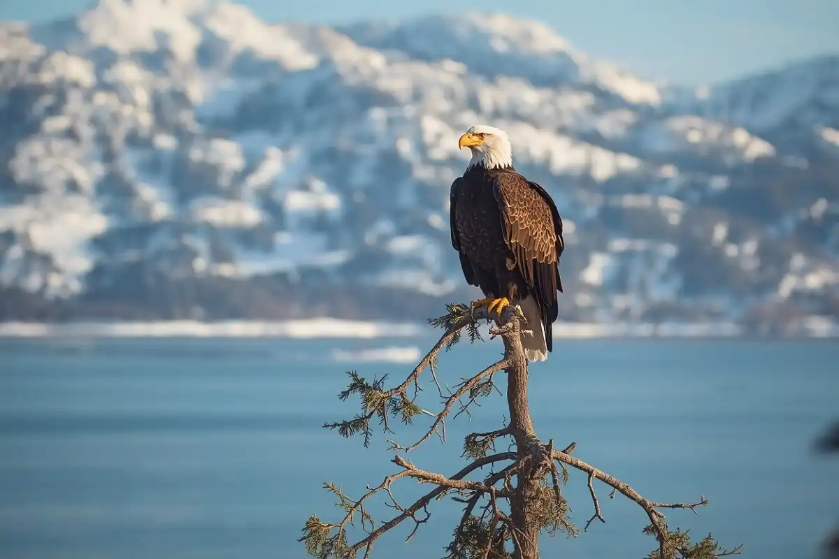
Bald eagles winter along the north shore, and if you time it right you can spot one from an easy path. The elevation helps too, since it keeps summers milder than the valleys below and turns winter trails into snowshoe routes. That range of terrain is exactly why so many of the best hiking trails in Big Bear CA stay on my regular rotation.
Easy Big Bear trails for families and first-timers
Alpine Pedal Path
The Alpine Pedal Path is the easiest way to hike Big Bear with kids, strollers, or bikes. This paved multi-use trail runs along the north shore of the lake, and it is famous for bald eagle sightings in winter.
Because it stays flat and smooth, it also works for wheelchairs and first-time visitors. You can turn around whenever you like, so it never feels like a forced march. If your kids have never seen an eagle in the wild, start here.
Happy Hills Trail
Happy Hills is a short paved loop that suits toddlers and older guests who still want to get outside. It starts near Big Bear City Hall and winds past picnic tables, so a slow stroll works fine. You can bring leashed dogs, too.
For a first taste of the mountains without any elevation, this one is hard to beat. If you are brand new to hiking, an easy paved warmup like this builds confidence before you tackle the dirt .
Moderate Big Bear trails: the sweet spot
Moderate trails are where Big Bear really shines, and they hold most of my favorite half-day hikes. For most visitors, these three rank among the best hiking trails in Big Bear CA, and none of them demands a full day.
Castle Rock Trail
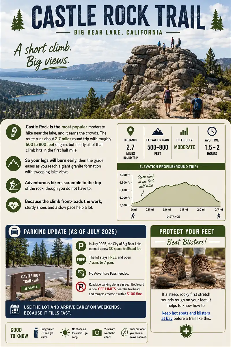
Castle Rock is the most popular moderate hike near the lake, and it earns the crowds. The route runs about 2.7 miles round trip with roughly 500 to 800 feet of gain, but nearly all of that climb hits in the first half mile.
So your legs will burn early, then the grade eases as you reach a giant granite formation with sweeping lake views. Adventurous hikers scramble to the top of the rock, though you do not have to. Because the climb front-loads the work, sturdy shoes and a slow pace help a lot.
Parking update
Here is the current parking situation, which changed recently. In July 2025 the City of Big Bear Lake opened a new 38-space trailhead lot that stays free and open 7 a.m. to 7 p.m., with no Adventure Pass needed.
Roadside parking along Big Bear Boulevard is now off limits near the trailhead, and rangers enforce it with a $100 fine. Therefore, use the lot and arrive early on weekends, because it fills fast.
If a steep, rocky first stretch sounds rough on your feet, it helps to know how to keep hot spots and blisters at bay before a trail like this.
Cougar Crest Trail to Bertha Peak
Cougar Crest is the classic north-shore climb, and it links up to the Pacific Crest Trail on a high ridge. The main trail runs about 5 miles round trip with around 800 feet of gain, which most moderate hikers handle comfortably.
However, if you push on to Bertha Peak, expect about 7.3 miles and roughly 1,350 feet of gain, with the steepest, rockiest stretch saved for the last mile.
From the top you get panoramic views across Big Bear Lake toward the ski resorts and the Mojave beyond. The Pacific Crest Trail section up here has loose footing, so watch your step near the ledges.
Parking & water
Parking needs an Adventure Pass at the Cougar Crest trailhead. Alternatively, park free at the Discovery Center until 6 p.m. and walk about 0.6 miles to the start.
Because the trail faces south and stays sunny, bring more water than you think you need.
Since the terrain turns rocky and steep at the end, whether trekking poles are worth carrying is a fair question, and on this one they earn their keep.
Pine Knot Trail to Grand View Point
Pine Knot to Grand View Point is my pick when I want forest, wildflowers, and a payoff view in one outing. The trail runs about 7 miles round trip with roughly 1,200 feet of gain, starting from the Aspen Glen Picnic Area on the south shore.
It climbs through shaded fir and Jeffrey pine on gentle switchbacks, then opens at Grand View Point (7,784 feet). From there you look straight at San Gorgonio, and on a clear day you can even pick out Catalina Island off the coast.
Because Aspen Glen has restrooms and picnic tables, it charges a fee, so bring an Adventure Pass. Fall turns the oaks gold here, which makes late October my favorite window.

Big views for strong hikers
Butler Peak Fire Lookout
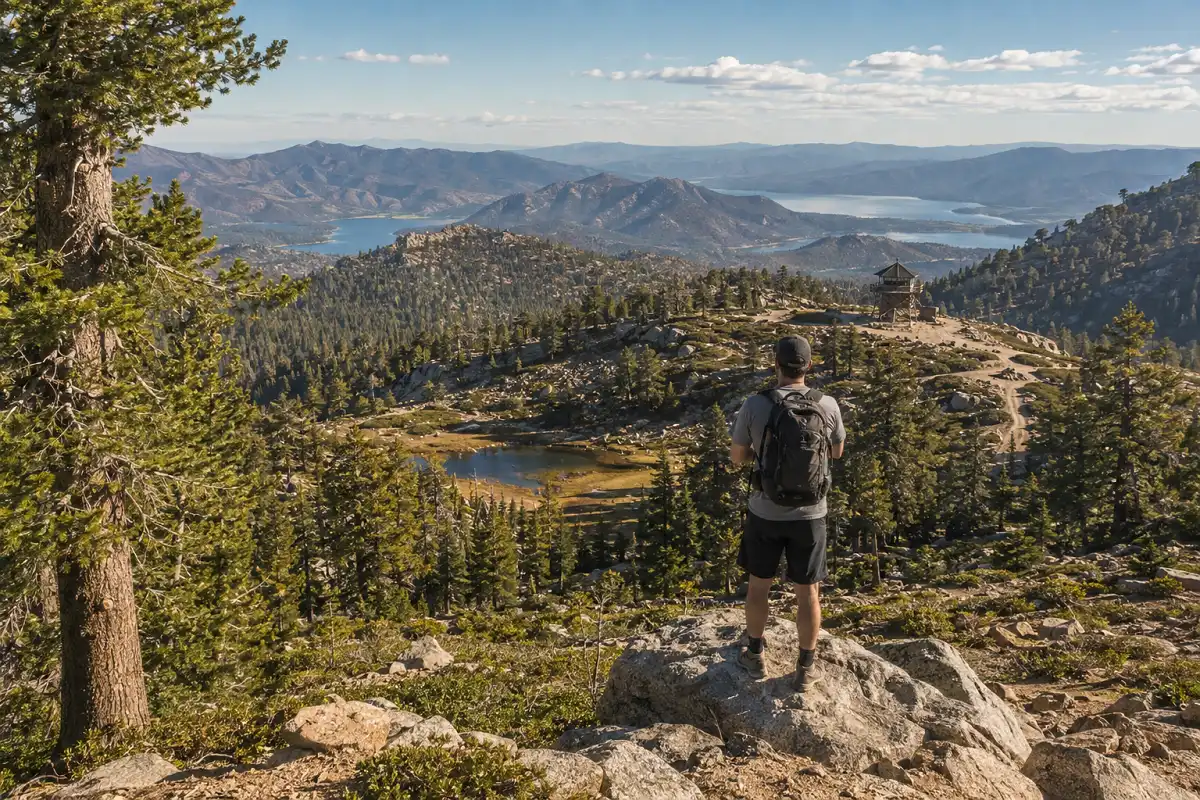
Butler Peak crowns one of the highest points between Big Bear Lake and Lake Arrowhead at 8,537 feet, and it is one of the few spots where you can see both lakes at once.
The lookout tower celebrates its 90th anniversary in 2026, and volunteers usually staff it from Memorial Day through Labor Day. If the gate on Forest Road 2N13 is open and you have a high-clearance vehicle, you can drive most of the way up.
Otherwise plan on a long dirt-road hike, often around 9 miles round trip with roughly 1,500 feet of gain. There is no Adventure Pass needed at the lookout itself, which is a nice bonus.
Seasonal road closure
Keep in mind that roads 2N13 and 2N13B close every winter once snow piles up, so summer and fall stay your best windows.
Bluff Lake Reserve
Bluff Lake is a quiet alpine basin that most visitors never find, tucked in the pines above the south shore. It sits inside a Wildlands Conservancy preserve, so it stays peaceful and undeveloped.
My favorite way in climbs past Castle Rock and follows a fainter trail up to the meadow and lake, though a gentler approach uses Bluff Lake Road.
Either way, the reward is stillness and old 1890s resort ruins scattered near the water. For a low-key afternoon with the family, few places beat it.
The big backcountry challenge: San Gorgonio
San Gorgonio — Old Grayback
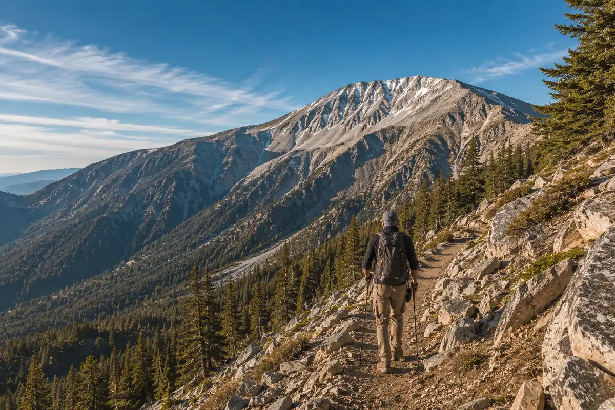
San Gorgonio is the tallest mountain in Southern California at 11,503 feet, and locals call it Old Grayback. This is not a lake stroll.
The highest peak in Southern California sits in the San Gorgonio Wilderness south of Big Bear, and its trailheads are a drive from the village.
From Forest Falls, the Vivian Creek Trail is the shortest and steepest route, running roughly 17 to 18 miles round trip with about 5,000 feet of gain. The South Fork Trail off Highway 38 runs longer but a touch gentler.
Either way, you need a free wilderness permit for day hikes and overnights, and the San Gorgonio Wilderness Association issues them online. Quotas fill early, so apply well ahead. You also need an Adventure Pass to park.
Save this one for when you have the fitness and, in winter, the snow gear and skills to match.
The distance, elevation gain and high altitude make this a very different objective from a lake stroll.
When to hike Big Bear through the year
Season shapes your options as much as fitness does when you chase the best hiking trails in Big Bear CA. Spring brings wildflowers and snowmelt, though upper trails stay muddy or icy into May.
Summer runs busy but cooler than the valley, so start early to beat crowds and afternoon heat. Fall is my favorite, because the black oaks turn red and gold in early October and the light gets soft.
Winter flips the whole valley into snow country. Then trails like Cougar Crest and the San Gorgonio approaches become snowshoe and microspike routes, and some forest roads close entirely.
Best seasons at a glance
Spring brings flowers and snowmelt. Summer is cooler but busy. Fall delivers the best color and light. Winter turns the area into snow country.
If you love cold-weather mileage, these are the snowy routes I keep coming back to . Dressing right makes or breaks a snow hike, so it pays to nail your layering for cold mountain days .
Permits, passes, and parking made simple
One last piece ties every hike together, because even the best hiking trails in Big Bear CA come with passes and rules worth knowing.
Most national forest trailheads
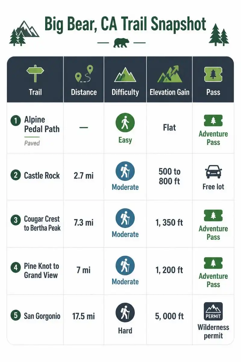
Most Big Bear trailheads in the national forest need an Adventure Pass, which costs $5 per day or $30 per year per vehicle.
Free trailhead lot
Castle Rock stands as the exception now, thanks to its new free lot.
Wilderness permit
San Gorgonio needs that separate free wilderness permit on top of parking.
No pass at the lookout
Butler Peak needs nothing at the lookout.
Layers, water & offline maps
Beyond passes, a few habits keep every hike smooth. Bring layers, since mountain weather shifts fast. Carry plenty of water, because sources are limited and many trails sit in full sun. Download your map ahead of time too, as cell service drops out on most ridges.
Finally, if you are eyeing a steep climb, it helps to understand how much elevation gain really adds up before you commit.
A quick word on bears and wildlife
Big Bear sits in black bear country, and yes, you may see one. Most of these bears wear brown or cinnamon coats, but they are all American black bears, not grizzlies.
They usually want nothing to do with hikers, so give them room and never feed them. Store snacks sealed, keep dogs close, and make a little noise on blind corners.
Rattlesnakes also come out in warm months, so watch where you step and where you reach.
Respect the wildlife, and it will treat you the same.
FAQs
What is the best hiking trail in Big Bear for beginners?
The Alpine Pedal Path is one of the easiest options because it is paved, flat and suitable for families, strollers, bikes and first-time visitors. Happy Hills Trail is another good choice for a short, relaxed walk with very little elevation.
Is Castle Rock Trail difficult?
Castle Rock is considered a moderate hike. The route is about 2.7 miles round trip with roughly 500 to 800 feet of elevation gain. Most of the climbing happens during the first half mile, so the beginning feels steep before the trail becomes easier.
Do you need an Adventure Pass to hike in Big Bear?
Most Big Bear trailheads in the national forest require an Adventure Pass for parking. Castle Rock is an exception because its newer trailhead lot is free and does not require an Adventure Pass. San Gorgonio also requires a separate free wilderness permit.
What is the best season for hiking in Big Bear?
Each season offers something different. Spring brings wildflowers and snowmelt, summer provides cooler mountain temperatures, fall offers colorful black oaks and softer light, while winter transforms many trails into snowshoe and microspike routes.
What is the hardest hike near Big Bear?
San Gorgonio is the major backcountry challenge mentioned in this guide. At 11,503 feet, it is the tallest mountain in Southern California. The Vivian Creek route is roughly 17 to 18 miles round trip with about 5,000 feet of elevation gain, making it a serious objective requiring appropriate fitness and preparation.
Choose the trail that matches your day
Big Bear rewards hikers at every level, from a paved eagle-watching stroll to an eleven-thousand-foot summit. That is the real appeal of the best hiking trails in Big Bear CA: there is a right one for every mood.
My advice stays simple: match the trail to your group, check the season, and sort out your pass before you drive up. Start with Castle Rock or Cougar Crest if you are new to the area, then work toward Butler Peak or San Gorgonio as your legs and confidence grow. Grab your boots, fill your water, and go see why these mountains keep pulling me back.